Rugosité
Sentinel1 google-earth files
To browse quicklook of Sentinel-1 easily we generate kml files. They are updated on a daily basis.
ml files are sorted in YYYY/MM tree view, and naming convention is the following:
ifremer_S1A_EW_RAW_04_2014.kml -> ifremer_satellite_mode_datatype_MM_YYYY.kml

mode | |
WV | Wave Mode |
EW | Extra Wide swath |
SM | StripMap |
IW | Interferometric Wide swath |
data type | |
RAW | L0 product |
SLC | L1 Single Look Complex |
GRD | L1 Ground Range Detected (GRDH: high resolution GRDM: medium resolution GRDF: full resolution) |
OCN | L2 Ocean product |
Monthly files are available for of the L0 and L1 sub products collected at Ifremer.
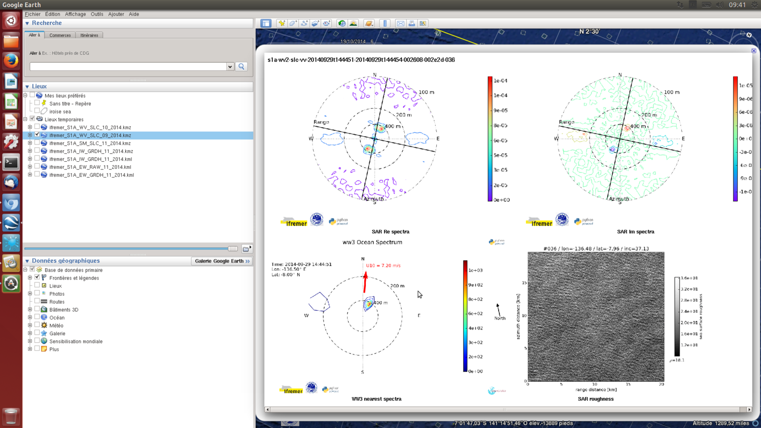
Note: WV_SLC and WV_OCN kml files contain roughness, cross-spectra and colocalized WW3 cross-spectra plots of each imagette.