REAPER reprocessing completed!
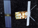
The full-mission reprocessing of the ESA ERS Radar Altimetry (RA) Level 2 data has been completed and the new data set is now available.
Record breaking wave heights and periods in the North Atlantic
The extra-tropical storm Quirin was caught blowing ocean waves up to significant heights of 20.1 m on February 14 in the middle of the Atlantic.
The Nephelae platform
CERSAT conceived the Nephelae demonstration platform.
Real-time time detection of a Karenia mikimotoi bloom from space in the Western English Channel in July 2010
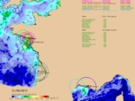
The exceptional bloom of karenia mikimotoi tooks place in July 2010 in the Channel.
Chlorophyll evolution in the subtropical gyres
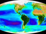
The now available decade of satellite sea colour data gives us the opportunity to follow the evolution of the chlorophyll concentration on these poorly-cloudy areas.
Observing storm-generated swell from space
International Polar Year: new Antarctic sea ice database
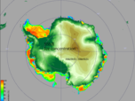
15-year archive over the two polar areas.
Sea Ice circulation in the north pole
A correlation analysis technique between successive maps is used to determine the movements animating this sea ice, mainly under the effect of the winds.
First validation results on JASON-1 altimeter
Jason data quality from comparisons with other altimeters.
Ocean colour and phytoplankton flora
A new Ocean Colour product is now available at CERSAT.
2012 Arctic sea ice melting reached a new record
Following the downward trend of recent years, the area covered by sea ice in Arctic has reached its lowest value since satellite observations began at end of the 1970’s.
End of ERS-2 mission after 15 years
ERS-2 was de-orbitated on 6th July, ending a 15 years long mission of earth observation.
Sea Surface Salinity measured from space for the first time !
A new method was developed that combine C and X-band brightness temperature measurements over the ocean to retrieve for the first time salinity is from satellite microwave radiometer measurements
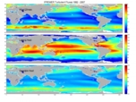
2008 New Release of Satellite Turbulent Fluxes
The new turbulent fluxes are estimated using Fairall et al (2003) bulk algorithm. The resulting weekly and monthly 10-m wind speed (W), 10-m specific air humidity (Qa), 10-m air temperature (Ta), wind stress (tau), latent heat flux (LHF), and sensible heat (SHF) flux fields are first validated against weekly and monthly averaged in-situ data.
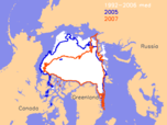
2007 Arctic sea ice melting: new record
The month of September of this International Polar Year is marked by a record: Arctic sea ice has hit its lowest value since the beginning of satellite observations exist (almost 30 years).
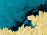
The oil spills of Prestige tanker observed from space
On 13th November 2002, the tanker Prestige was wrecked off Galice (Spain) after its crew was rescued.
CERSAT to release new satellite global mean wind fields
CERSAT provides the scientific community with easy-to-use synoptic gridded fields of wind-related parameters estimated from observations by NASA scatterometer SeaWinds onboard QuikSCAT.


