


International Polar Year: new Antarctic sea ice database
Radiometers onboard satellites are commonly used to estimate sea ice concentration and extent. For several years, CERSAT has been providing daily Arctic sea ice maps at 12.5 km resolution.
For the beginning of the International Polar Year 2007-2009, the database has been augmented with Antarctic data over the period 1992-present. Monthly maps and a 15-year climatology are also available.
CERSAT now provides this 15-year archive over the two polar areas.
|
|
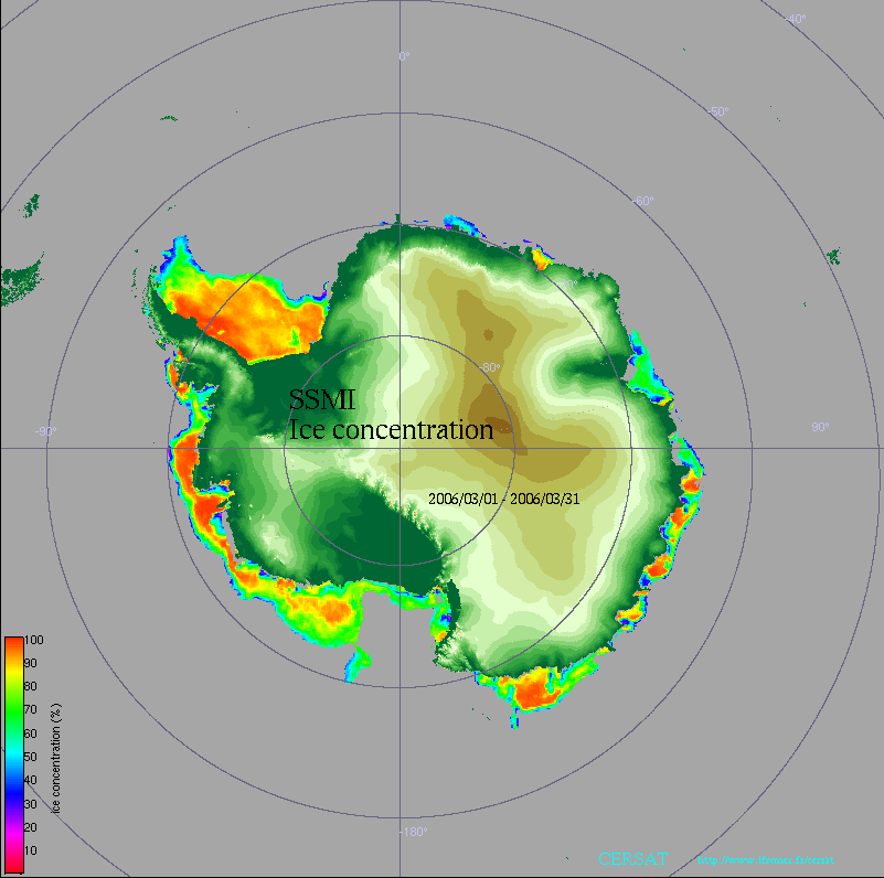
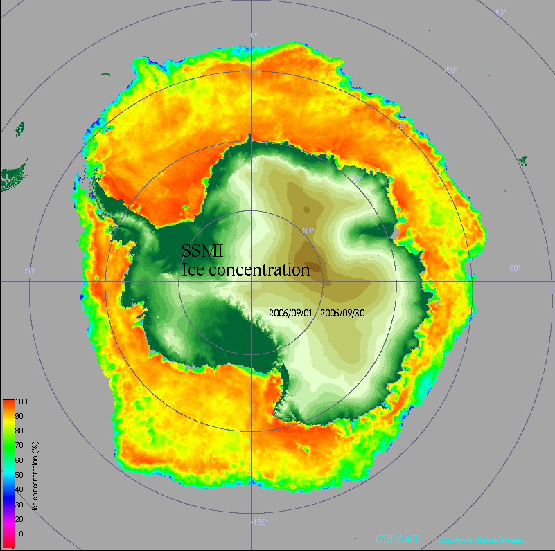
Figures 1 & 2 : Antarctic sea ice concentration in March and September 2006, from SSM/I radiometer data.
Data, quicklooks, movies and GoogleEarth files are available here.
More information about the 2007 Arctic sea ice melt record.